

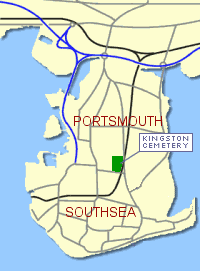
Google Map of Kingston Cemetery
Location:
Kingston Cemetery is located between St Mary's Road and New Road, Portsmouth. The main gate is on St Mary's Road Road and is accessible to cars. Parking is permitted along the full length of the central road. There is pedestrian access from New Road and George Street.
Further Information
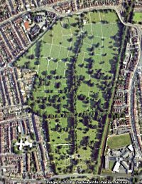
Kingston Cemetery covers 32 hectares and is the largest in Portsmouth. It was opened in 1856 and taken over by Portsmouth Corporation in 1895.
The War Graves
There are 570 men and women whose graves are maintained by the Commonwealth War Graves Commission buried in the cemetery, four of them belong to unidentified service personnel. We have listed them alphabetically according to the conflict in which they died. There are some who do not fit these categories and they have been listed separately.
The Grave References
Each of the graves identified in Kingston cemetery is allotted a grave reference number according to it's location. This consists of a section name, a row number and a grave number. A cemetery plan appears on each page together with a larger downloadable version in MS Word Format. During office hours the Cemetery Managers office, at Milton Cemetery, is open to assist.
Alphabetical List of War Graves
A-B | C-D | E-G | H-K | L-M | N-R | S-T | U-Z (And Others)