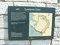
Location
On the north side of St George's Road. The plaques are on the right hand wall facing St George's Road.
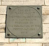
Plaque 2
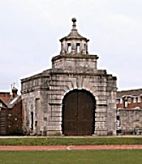
Landport Gate (Inner, 2004)
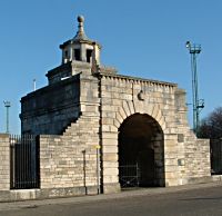
Landport Gate (Outer 2004)
"LAND PORT"
THE PRINCIPAL ENTRANCE
INTO PORTSMOUTH
PREVIOUS TO
THE DEMOLITION OF THE
FORTIFICATIONS
1875
Inscription 2
Further Information
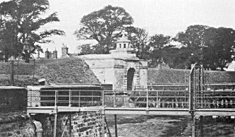
The Landport Gate was not the first such access point through the ramparts on the North side of the town. In 1665, an expert in town defences, Sir Bernard de Gomme was invited to improve the fortifications. It is ironical that de Gomme was Dutch when at a time the principal threat was seen to come from Holland. De Gomme raised the ramparts and placed his town gate at the end of the High Street, roughly where the roundabout at the end of Cambridge Road is now sited. We know of no illustrations of this gate.
In 1760 it was decided that for defensive purposes it made more sense to have the town gate in the centre of the northern ramparts and at that point the old gate was dispensed with and the Landport Gate constructed half way between the Town Mount Bastion and Guy's Bastion. It had a drawbridge which led to the Landport Ravelin, from which a smaller drawbridge would lead to solid ground and what was then known as the London Road. Whilst this may have had strategical logic it did mean that on entering the town visitors were confronted with the relatively minor Warblington Street rather than the main thoroughfare of High Street.